Jenn Eckerle is an Ocean Policy Analyst that has been consulting for NRDC's Oceans Program in San Francisco since 2008. She helped lead the effort to create marine protected areas in Southern California and is currently focused on ensuring the lasting success of the state's entire protected area network. Jenn also works on fisheries management, desalination, underwater noise, and oil drilling issues in California. She is an East Coast transplant that has spent the last two decades trying to forget the cold winters of New York. Jenn loves being outdoors, especially when it involves camping, hiking, scuba diving, swimming, or paddle boarding. She has a B.S. degree from the University of Vermont and an M.S. degree from the Florida Institute of Technology.
Marine Protected Areas Work to Restore Ocean Health: A Decade of Protection at the Northern Channel Islands
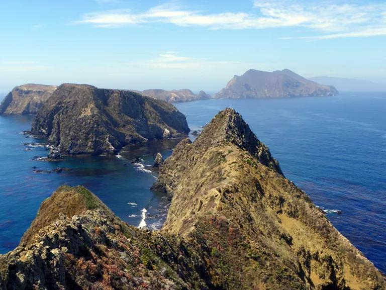
Four of the northern Channel Islands--Anacapa, Santa Cruz, Santa Rosa, and San Miguel--rise dramatically from the continental shelf like a terrestrial mountain range, geological evidence of the earth's crust shifting and colliding millions of years ago. The islands stretch across the sea but hover closely together side by side, as if a giant skipped a stone and land formed at each contact point.
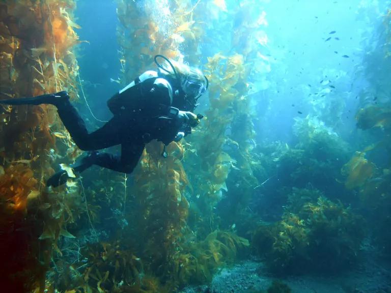
The underwater world of these islands is equally spectacular. Kelp reaches from the depths, creating dense canopies reminiscent of redwood forests and providing a home to species like kelp bass and California sheephead. Seagrass beds sway in the nearshore currents, serving as a nursery and shelter for young fish and invertebrates. And rocky nooks and ledges covered with urchins, anemones and brightly colored encrusting algae provide a hiding place for spiny lobsters and other marine animals.
Just a quick boat ride from urban population centers in Southern California, the northern Channel Islands, which lie within the boundaries of both the Channel Islands National Marine Sanctuary and Channel Islands National Park, attract hundreds of thousands of boaters, divers, fishermen, students, and wildlife enthusiasts annually, generating over $205 million for local coastal communities from commercial fishing and tourism alone.
This is a truly special place on the planet.
But during the late nineties, recreational anglers began to notice declines in fish and invertebrate populations around this special place. In response, a group of resource managers, environmentalists, fishermen, and others began working together to designate a portion of the islands' surrounding waters off-limits to fishing. The culmination of this effort occurred in 2003 when thirteen marine protected areas (MPAs) were created within state waters around the northern Channel Islands and then expanded to federal waters in 2007. These areas, most of which prohibit fishing within their boundaries, were designed to restore biodiversity and ecosystem health by protecting marine life and habitats.
To determine whether these MPAs are meeting their ecological goals, scientists from the Partnership for Interdisciplinary Studies of Coastal Oceans (PISCO) have been monitoring rocky reef and kelp forest communities at the islands for over a decade. In 2008, after only five years of protection, PISCO found that both the numbers and size of fish species targeted by fishermen at the Channel Islands was greater inside MPAs compared to reference areas outside. These initial patterns were promising indicators that protected areas were generating benefits for marine life; however, it was understood that full benefits would likely take decades to develop.
The Channel Islands MPAs celebrated their ten-year anniversary in 2013. This milestone provided the opportunity for PISCO scientists to review a longer-term data set covering a decade of monitoring. The updated analyses builds on the previous five-year "inside vs. outside" MPA comparison and include a new evaluation that examines ecological changes over time since the MPAs were created. Results indicate that positive effects observed after five years have continued and the Channel Islands MPAs appear to be fulfilling their role as refuges for many fish and invertebrate species.
Some notable findings:
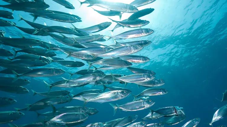
- Overall, fish and invertebrates are bigger and more plentiful than five years ago in the areas studied. The average biomass of fish targeted by fishermen, such as rockfish, increased both inside and outside of MPAs since the five-year review, with a much greater increase inside MPAs. Invertebrate species heavily targeted by fishermen such as California spiny lobster, sea cucumber, and red urchin, are more bountiful within reserves. Unfished or lightly fished invertebrate species did not show any consistent patterns of change inside and outside MPAs.
- Protected areas at the Channel Islands generate more fish and bigger fish in less time. On average, the size and number of targeted fish species increased more rapidly inside MPAs compared to areas outside.
- Shifts in fishing effort do not appear to be affecting fish populations in open areas adjacent to MPA boundaries. Increases in targeted fish species in reference areas outside MPAs suggests that changes in fishing behavior as a result of MPA designation are not causing fish declines in nearby, unprotected waters. The causes of fish increases outside MPAs are unclear, but could be attributed to changes in fishing patterns and/or ocean conditions, fish moving from MPAs to fished areas outside, or some combination of these factors.
- Individual MPA responses can vary. Recent studies indicate that ecosystem response to MPAs relies on a combination of factors including location, size, habitats protected, and level of fishing pressure. PISCO's results provide further evidence that not all protected areas perform the same way. In warmer waters around the eastern islands (where species composition and fishing patterns differs from colder water to the west), biomass of targeted fish and invertebrates was higher in MPAs compared to outside--a difference that was not observed in colder waters around San Miguel.
The results from the Channel Islands ten-year update are encouraging, especially since these protected areas are now an integral component of the southern reach of California's statewide network of MPAs. While benefits from the state's newly established MPAs will likely take years to develop, the positive effects observed at the Channel Islands are a harbinger of what we hope to see over time.
Monitoring at the Channel Islands shows that MPAs convey direct benefits to fish and invertebrates that are targeted by fishing. Improvements seen within MPA boundaries will likely spill over to unprotected waters, helping improve overall ocean health and building resiliency against the pressures of climate change, overfishing and other threats facing coastal waters. MPAs are one tool that can help combat the degradation and wildlife loss occurring in oceans worldwide.
PISCO's updated progress report focuses on just one component of the underwater ecosystem at the islands; other researchers have been monitoring deep water and nearshore habitats. Ultimately, folding all these pieces together will paint a more complete picture of MPA responses at the Channel Islands.
To fully understand the performance of California's MPA network over time--and ensure these areas are reaching their full potential--ongoing monitoring of the Channel Islands MPAs and rest of state's protected areas will be critical. Continued monitoring also provides the benefit of leveraging MPA designations as living laboratories, establishing a benchmark from which to measure the impacts of existing and emerging ocean stressors.
To assist with this effort, the South Coast MPA Baseline Program began in 2012. In this program, scientists, fishermen, and citizen science groups are working together to understand ecological ocean conditions and human uses when MPAs in Southern California took effect. MPA monitoring at the northern Channel Islands contributes to this body of knowledge. Over the next year, results from this baseline program will be integrated with other research and monitoring activities in the area, developing a comprehensive backdrop of the region and a point of reference against which future changes can be measured. You can learn more about MPA monitoring activities in Southern California at http://oceanspaces.org/monitoring/regions/south-coast.
Happy (belated) anniversary, Channel Islands MPAs. May you continue to thrive and invoke a sense of mystery, majesty and bounty that Californians can experience now and in the future.
Related Blogs

Canyons & Seamounts Marine Monument Update
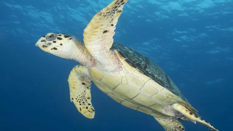
Sea Turtle Week Highlights a Need to Safeguard Ocean Habitat